Monday, March 29, 2010

Day 6: Mesa to Globe, AZ

Distance: 77.2 mi
Cumulative Distance: 500.9
Average Speed: 14.1
Climb: 5,709
Cumulative Climb: 29,847

A beautiful morning with calm winds greeted us at Mesa. The sky has been cloudless for the last five days and as a result we are getting bikers’ tans - face, arms and legs from just above the knees, are all nicely browning.

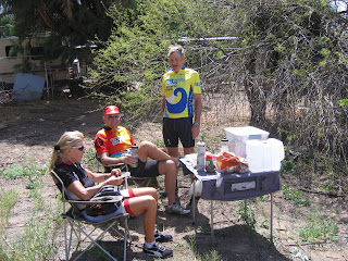
We have settled into a fairly regular routine: first of all, the person driving does most of the picture taking; goes about 1/8 of the days distance and waits for the group where we have a short break and fill up our water bottles, then drives to about ¼ of the distance where we switch drivers. This routine continues for the rest of the day so each of us drives ¼ of the total distance. The luck of the draw determines who is in the car for the steepest part of the day. Today was Gaby's lucky day - she missed the 8% grade.


The counrtyside is very beautiful and quited rugged.

We have entered the San Carlos Apache reservation and are staying at the Best Western Apache Gold hotel which is adjacent to the casino. The rooms are great, but not much gambling is expected.

Sunday, March 28, 2010

Day 5: Aguila to Mesa, AZ

Distance: 106.0 mi

Cumulative Distance: 423.7
Average Speed: 16.1
Climb: 3,774
Cumulative Climb: 24,138


It was another day of big changes and a few surprises. We started from the Burro Jim Motel in Aguila, population 576, with a temperature of 40° F, but no wind after the strong headwinds of the prior two days. We climbed for the first 10 miles but the rest of the day was generally downhill. We went through Wickenburg, the dude ranch capital of the world and on through Phoenix to Mesa, where we ended our day in 80° F temperature.


As we have come further into Arizona the saguaro cacti have become more prevalent. We were able to ride along a canal through much of Phoenix and its suburbs. The excitement of the day was Lee breaking a ratchet on his bike shoe causing us to visit two bike shops and extend our planned 90 mi day to 106. So far, each of us has had a flat, Gaby has broken a pedal strap, Lee has broken a shoe ratchet and had to replace a chain, it is good to keep track of the location of the nearest bike store.


After over 70 miles in the saddle, Gaby contemplates another mode of transportation!

A word about our route and navigation. We are following the Southern Tier of the Bicycle Touring Map of the Adventure Cycling Association. They are excellent maps; they give the street name and distance of every turn as well as an elevation profile of the route (some look scary), field notes and a service directory of what is available in each place along the way. There are seven sections of maps in the set for the Southern Tier and each sheet has 15 maps of about 30 miles. So there are 107 of these strip maps in all.


Dave has a Garmin bicycle GPS. He uses a software program called MapMyRide, which uses Google Maps, to trace each route for the day. Each day’s ride is then uploaded into the Garmin. As we travel along we get a readout on the GPS of each turn. We therefore do not have to keep referring to the maps as we ride along. It is also the source of the distance, speed, elevation change and other information; a very neat device.

Day 4: Blythe, CA to Aguila, AZ

Distance: 89.4 mi
Cumulative Distance: 317.7
Average Speed: 14.4
Climb: 5,765
Cumulative Climb: 20,364


Goodbye California, Hello Arizona!

We woke this morning to more gusty winds, from the northeast - they would haunt us on our face all day. Where are the southwesterly wind we were promised?


First a point of clarification - after day three, we all enjoyed the format of rotating drivers with each of us driving a portion of each day’ ride, so we decided to do it for the entire trip.

This morning we left our oasis in Blythe, CA holding onto our helmets in the wind and headed across the Colorado River into Arizona. We parted way with Emilio, our Italian friend, and with the Adventure Cycling group that had left San Diego three days ahead of us. We travelled a lot of miles on interstate 10 and experienced flat tire number four along the way.


Dave was charged with finding a picnic spot with a bit more class than the one Lee chose yesterday. Dave outdid himself with a four star picnic area with many amenities. Our three intrepid golfers were even inspired to play a round of imaginary golf.


Since we were spending the evening in Aguila with only one motel, Dave had booked in advance. No one answered the phone but we eventually received a call back confirming we had rooms 1, 7 and 9. We were advised that they would be unlocked so that we should just go right in - the owner would book us in later. We arrived at the Jim Burro and found this!


After some minor debate we loaded up the bikes and headed for the next town 26 miles away. As we were leaving Aguila we spotted the actual Burro Jim motel. We were thrilled with the upgrade and spent the night there.

Friday, March 26, 2010

Day 3: Brawley, CA to Blythe, CA

Distance: 86.7 mi
Cumulative Distance: 228.4 mi
Average Speed: 14.6 mph
Climb: 5152 ft
Cumulative Climb: 14,599 ft

The word for today was WIND. So much for the prevailing westerlies. Our route was just slightly north of east but we had head winds most of the day plus uphill (see above). It was a tough ride.

We passed some areas that were very pretty with flowers.


An some areas that were not.


Lee found us a delightful spot for lunch.


Toward Blythe we are passed through a very fertile, irrigated valley with mountains surrounding the very flat, very productive area.
Und hier was fur die Leute die nur deutsch sprechen.
Der Tag fing an mit schlechter Strasse, dann eine umwefende Sicht mit Duenen auf der einen Seite und den Bergen auf der anderen. Danach hatten wir bis auf kurze Strechen einen schrecklichen Wind. Wieder ein Tag mit vielen Eindrucken. Trotzdem waren wir alle froh, als wir in unserem Best Western ankamen. Nun freuen wir uns auf einen neuen Tag.

Thursday, March 25, 2010

Day 2: Pine Valley to Brawley

Distance: 88 mi
Cumulative distance: 143 mi
Average speed: 16.6 mph
Climb:3435 ft
Total climb: 9447 ft

We started our second day in Pine Valley, CA at an elevation of 4000 ft and a temperature of 36 degrees. 

We quickly climbed 500 feet to our highest elevation in California of 4500 ft.  The ride for the rest of the day was mostly downhill as we ended in Brawley, CA at an elevation of 113 ft below sea level and a temperature of 80, which is about as good as it gets in this low desert area. We rode through the Yuma Desert, lunch on the road.

We rode along the US/Mexican border for a good part of the day.  Often we were close to the ugly wall the US has put up to slow down illegal immigration.


Along the way we met Emilo from Italy, who lives in Brussels working for the European Commisssion.  He is doing the same ride we are on a solo basis.  Our new group of two
Americans, a Canadian, a German, and an Italian plan to have a nice Mexican dinner tonight.


Wednesday, March 24, 2010

We're off!

24 Mar
Distance: 55 mi
Avg Sped: 12.25
Climb: 6012 ft

It was a foggy morning in San Diego when we began our ride. We completed our Pacific Ocean dip (photo above) suffering only lost one pair of sunglasses in the surf and a few pairs of wet shoes from a rougue wave.Within the first 12 miles we had two flat tires and a broken pedal clip strap. Following a detour to a bike shop to pick up a used strap, courtesy of Bruce found on his Droid telephone, the sun came out and we were on our way in perfect California weather. As you can tell from the stats above, it was a TOUGH ride for us flatlanders. We were rejuvenated by a fine lunch in Alpine and all arrived safely at our home for the night in Pine Valley (photo below). Three of us took turns driving, but Dave and his son, Bruce (who joined us for the day) both completed the whole ride - congratulations to both of them!


By Lee for all of us

Sunday, March 21, 2010

California

One of us has made it to California!

Lee and Fran left Bonita Bay on 15 Mar with four bikes and some of the support stuff (tools, lube, extra shoes etc). They are stopping in Texas on the way across to visit relatives and expect to arrive in San Diego on 22nd. Gaby also plans to arrive that day, Keith on 23rd and I arrived yesterday to spend some time with my son and his family. The pic is my son Bruce, my grandson Jacob and me after a ride here in south Orange County. Bruce is plannning to ride the first day with us so he and I will head for the motel in San Diego on Tuesday evening.

We're getting close.

Dave for all of us.