Saturday, April 3, 2010

Day 11: Anthony (El Paso) to Fort Hancock, TX

Distance: 83.3 mi (134.0 km)
Cumulative Distance: 934.4 (1,503.8 km)
Average Speed: 17.9 (28.8 kph)
Climb: 2,540 ft (774.2 m)
Cumulative Climb: 52,540 (16,014.2 m)
Flats: 1
Cumulative Flats: 7

Our first day in Texas started with us going back into New Mexico as we circled El Paso. Sometimes you have to take a step back to go forward. The area west of El Paso is high desert with some pretty mesas. East of El Paso is expansive farm land.

We are again a few miles from the Mexican border and the population is predominately Mexican.

We had a great (easy) day of 84 miles with a favouring wind most of the day. This allowed us to stop for a leisurely lunch at a café in Tornillo, instead of the usual hurried peanut butter and jam sandwich on the road.

When we arrived at the Fort Hancock Motel (Fort Hancock has a population of 1000), we met Vera and Hank, a couple form Holland, who are crossing the country on the same route that we are. Two years ago they biked the mid-America route form Virginia to Oregon. They had many interesting stories of their many bike trips at various places around the world. They joined us for dinner at Angies’, the only place in town. We had great conversation and some decent food - the apple pie is apparently famous so of course we had to try it.


Friday, April 2, 2010

Day 10: Hillsboro, NM to Anthony (El Paso), TX

Distance: 108.1 mi (174.0 km)
Cumulative Distance: 848.1 (1,364.9 km)
Average Speed: 18.7 (30.1 kph)
Climb: 3,732 ft ( 1,138 m)
Cumulative Climb: 52,000 (15,850 m)
Flats: 1
Cumulative Flats: 6

Goodbye New Mexico, Hello Texas

Following a healthy breakfast in a café in the historic little village of Hillsboro, we departed on our ride in sunny but chilly conditions. After an early climb out of the valley, it was a slightly downhill ride all the way to Texas.

We took advantage of the good riding conditions to average 18.7 mph for the full ride. As you can see from the stats above, the ride was over 170 km at an average speed of over 30 kph. That's not Tour de France stuff, but bad for a bunch of old -----! Daily average so far is 85 miles.


About halfway thru the ride we experienced our sixth flat - Gaby again (she now has three and we each have one apiece). There is a more farming and animals in the fertile valley west of Las Cruces. Don't know what these horeses were finding to eat - looks like sand - but when Lee tried to entice them with the end of his Clif bar, they weren't interested.

The scenery today was less spectacular then it was in the mountains. Toward Las Cruces we rode thru endless pecan orchards and a picture is included.


Lunch was at a park just West of Las Cruces. We arrived at the park before Gaby, who was driving at the time and was charged with picking up bread and cheese. She got lost looking for the park so we had a nice rest while she looked for it. This experience confirmed what we already suspected, based on a previously unreported incident in Mesa, that Gaby is a bit directionally challenged. In Mesa she had so much trouble trying to find the motel that she resorted to hiring a taxi (for $40) to lead her to the motel!

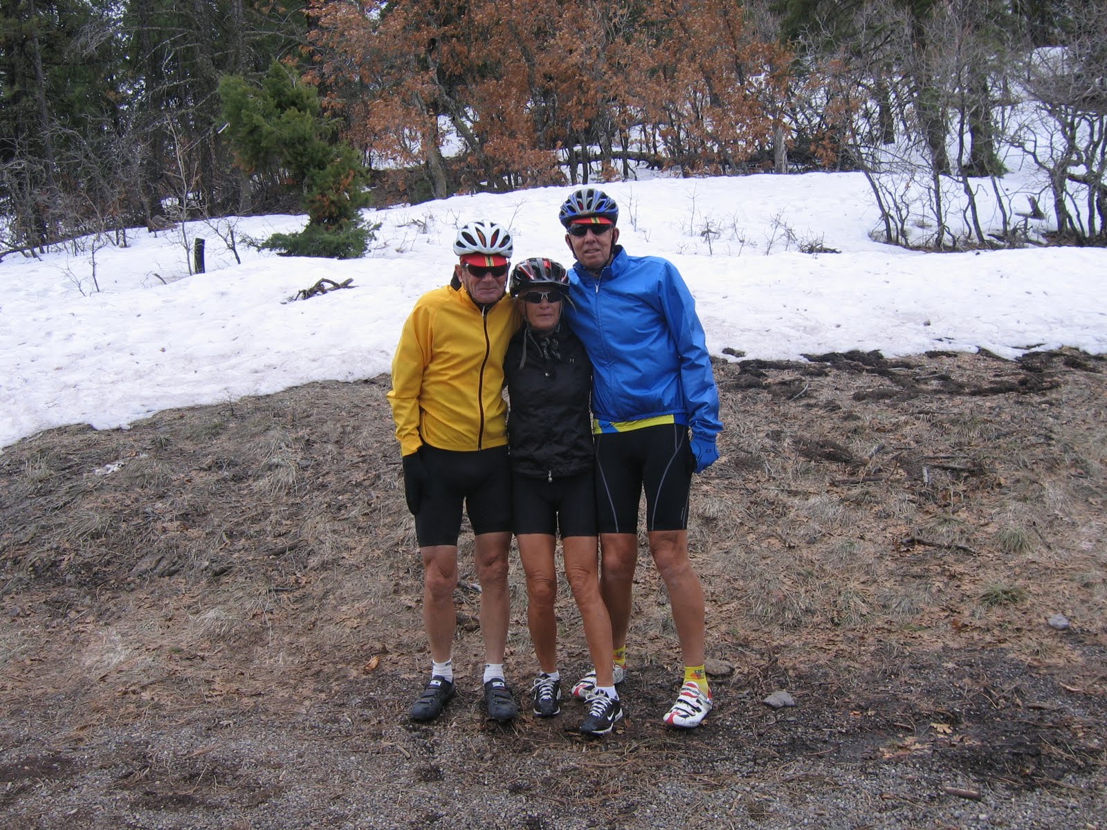
Here's Dave waiting for Gaby today.

We finished the ride in Anthony, Texas, just West of El Paso - barely past the New Mexico border. Tomorrow we begin a long and challenging trip across this giant state and are hoping that the good fortune we have enjoyed so far with the weather will continue!


Thursday, April 1, 2010

Day 9: Silver City to Hillsboro, NM

Distance: 55.2 mi (88.8 km)
Cumulative Distance: 740.0 (1,190.9 km)
Average Speed: 14.4 (23.2 kph)
Climb: 5,784 ft (1,763.0 m)
Cumulative Climb: 48,268 (14,712.1 m)
Flats: 0
Cumulative Flats: 5

Since we had planned a shorter ride today, we decided on a slightly later start; we didn’t hit the road until 9:00 AM. It was cool and it got colder. But we finally got our westerly winds. They were even a bit too strong at times - very gusty at the higher elevations and switchbacks.

Just east of Silver City is the Santa Rita copper mine. It has a storied history, produced a lot of copper and is now an open pit mine.

The big challenge for today, and the reason for the shorter ride, was Emory Pass. At 8228 feet, it is to be the highest point on our route (yeah, we crossed the Continental Divide yesterday, but Emory Pass, though not on the divide, is higher). As you can tell from the pictures, it was COLD. Sure we could have had on long pants but we’re bikers!


There was lots of snow around.


And again some wonderful vistas.

Keith had made hotel reservations yesterday. Angela, the proprietor, told him there was no café in town so, for $10 apiece, she will cook us dinner. (We did buy a carrot cake for dessert, desserts seem to be big with this crowd. Forgot to tell you about the desserts a couple of days ago, the bread pudding Keith had and the merionberry torte for Gaby - were HUGE).

We arrived at the motel shortly after noon and had lunch on our front “patio”.


With the spare time and no internet distractions, we did some minor bike maintenance. Keith installed a new computer on his.

Tomorrow we're headed for Anthony, a suburb of El Paso, about a 110 mile trip. Because of the time change it is still quite dark and we expect tomorrow quite cold, at 8:00 AM so we'll probably delay our departure an hour.

Wednesday, March 31, 2010

Day 8: East of Safford, AZ to Silver City, NM

Distance: 88.1 mi (141.8 km)
Cumulative Distance: 684.8 (1,102.1 km)
Average Speed: 14.6 (23.5 kph)
Climb: 7,306 ft (2,226.8 m)
Cumulative Climb: 42,484 (12,949 m)
Flats: 0
Cumulative Flats: 5

Goodby Arizona, Hello New Mexico

We exercised our high altitude climbing legs today with the hardest day of the trip. We started the day with a climb of over 2,500 ft in the Apache National Forest to an elevation of 6300 ft.


Then a 10 mile descent and a border crossing to New Mexico and into the Gila National Forest. Most of our day was above a mile high and our lunch stop was exactly 5,280 ft.


We were in beautiful mountain wilderness throughout the day with very little traffic. You can just see three of us approaching one of the switchbacks in the picture above. And in the one below, the picture was taken from the road farther up another switchback. Tough climbing!


Here is the profile of today's climb. Sorry it is a bit fuzzy but unusual manipulations were required to get it imported to the blog.

At our lunch spot a hitchhiker and his dog were heading in the opposite direction, with only a few shots at finding a ride. Shortly after lunch we met a one legged biker also going across the USA on the Southern Tier Route, but he was travelling from east to west. His wife is driving the support car. They were hoping to make it to Safford tonight but it was over 70 miles away so they are faced with a night of camping. Fortunately there are several campsites in the National Forests.

Late in the day, about four miles from Silver City, we crossed the continental divide at 6,230 ft and then downhill to our destination. Tomorrow we go higher - stay tuned!


Tuesday, March 30, 2010

Day 7: Mesa to Safford, AZ

Distance: 95.8 mi
Cumulative Distance: 596.7
Average Speed: 15.5
Climb: 5,331
Cumulative Climb: 35,178
Flats: 5 (4 previous and 1 today)

We prepared to start the day with a hearty casino breakfast, however, when we knocked on Dave’s door at 7AM a groggy Dave appeared at the door after having been awoken from a sound sleep. It turns out he did not set his alarm properly. He managed to appear at the restaurant in record time (without a shower) and got packed up in record time, so we got off on our ride without any delay.


It was another beautiful sunny Arizona morning with light winds from the north. The winds stayed that way most of the day and we even enjoyed a little tailwind for about 15 miles of the ride. The scenery was spectacular again, all day, and we arrived, 68 miles later, at our motel for the


evening in Stafford (another Best Western - we are in a Best Western rut). En route, we experienced flat tire number 5 - Gaby this time. We enjoyed a leisurely lunch in one of our motel rooms and then proceeded to turn what had been a relatively relaxing day into another hard one

by riding an additional 27 uphill miles to a mountain pass that was on tomorrow’s route to Silver City (after getting to the pass, we then drove back to Stafford). This planned extension will make tomorrows tough ride to Silver City a bit easier, by cutting off 27 miles and one climb.


At the conclusion of the day we enjoyed our customary beer or two as we went over plans and strategies for the next day.


Und wieder ist ein schoner Tag zu Ende. Das Wetter ist gut, wenn auch der Wind nicht immer in die Richtung blaest, die wir es gerne hatten. Nach dem dritten Abschnitt kamen wie zum Hotel, wo Lee unsere Zimmer bestellt hatte. Wie schoen ware es gewesen, den Nachmittag hier zu verbringen. Aber nein, wir mussten noch 27 Meilen fahren und es ging nur bergauf. Da muss man sich schon zusammen reissen, aber es ist ein tolles Gefuhl, wenn man es geschafft hat. Und…. Morgen geht es weiter.

Monday, March 29, 2010

Day 6: Mesa to Globe, AZ

Distance: 77.2 mi
Cumulative Distance: 500.9
Average Speed: 14.1
Climb: 5,709
Cumulative Climb: 29,847

A beautiful morning with calm winds greeted us at Mesa. The sky has been cloudless for the last five days and as a result we are getting bikers’ tans - face, arms and legs from just above the knees, are all nicely browning.

We have settled into a fairly regular routine: first of all, the person driving does most of the picture taking; goes about 1/8 of the days distance and waits for the group where we have a short break and fill up our water bottles, then drives to about ¼ of the distance where we switch drivers. This routine continues for the rest of the day so each of us drives ¼ of the total distance. The luck of the draw determines who is in the car for the steepest part of the day. Today was Gaby's lucky day - she missed the 8% grade.


The counrtyside is very beautiful and quited rugged.

We have entered the San Carlos Apache reservation and are staying at the Best Western Apache Gold hotel which is adjacent to the casino. The rooms are great, but not much gambling is expected.

Sunday, March 28, 2010

Day 5: Aguila to Mesa, AZ

Distance: 106.0 mi

Cumulative Distance: 423.7
Average Speed: 16.1
Climb: 3,774
Cumulative Climb: 24,138


It was another day of big changes and a few surprises. We started from the Burro Jim Motel in Aguila, population 576, with a temperature of 40° F, but no wind after the strong headwinds of the prior two days. We climbed for the first 10 miles but the rest of the day was generally downhill. We went through Wickenburg, the dude ranch capital of the world and on through Phoenix to Mesa, where we ended our day in 80° F temperature.


As we have come further into Arizona the saguaro cacti have become more prevalent. We were able to ride along a canal through much of Phoenix and its suburbs. The excitement of the day was Lee breaking a ratchet on his bike shoe causing us to visit two bike shops and extend our planned 90 mi day to 106. So far, each of us has had a flat, Gaby has broken a pedal strap, Lee has broken a shoe ratchet and had to replace a chain, it is good to keep track of the location of the nearest bike store.


After over 70 miles in the saddle, Gaby contemplates another mode of transportation!

A word about our route and navigation. We are following the Southern Tier of the Bicycle Touring Map of the Adventure Cycling Association. They are excellent maps; they give the street name and distance of every turn as well as an elevation profile of the route (some look scary), field notes and a service directory of what is available in each place along the way. There are seven sections of maps in the set for the Southern Tier and each sheet has 15 maps of about 30 miles. So there are 107 of these strip maps in all.


Dave has a Garmin bicycle GPS. He uses a software program called MapMyRide, which uses Google Maps, to trace each route for the day. Each day’s ride is then uploaded into the Garmin. As we travel along we get a readout on the GPS of each turn. We therefore do not have to keep referring to the maps as we ride along. It is also the source of the distance, speed, elevation change and other information; a very neat device.

Day 4: Blythe, CA to Aguila, AZ

Distance: 89.4 mi
Cumulative Distance: 317.7
Average Speed: 14.4
Climb: 5,765
Cumulative Climb: 20,364


Goodbye California, Hello Arizona!

We woke this morning to more gusty winds, from the northeast - they would haunt us on our face all day. Where are the southwesterly wind we were promised?


First a point of clarification - after day three, we all enjoyed the format of rotating drivers with each of us driving a portion of each day’ ride, so we decided to do it for the entire trip.

This morning we left our oasis in Blythe, CA holding onto our helmets in the wind and headed across the Colorado River into Arizona. We parted way with Emilio, our Italian friend, and with the Adventure Cycling group that had left San Diego three days ahead of us. We travelled a lot of miles on interstate 10 and experienced flat tire number four along the way.


Dave was charged with finding a picnic spot with a bit more class than the one Lee chose yesterday. Dave outdid himself with a four star picnic area with many amenities. Our three intrepid golfers were even inspired to play a round of imaginary golf.


Since we were spending the evening in Aguila with only one motel, Dave had booked in advance. No one answered the phone but we eventually received a call back confirming we had rooms 1, 7 and 9. We were advised that they would be unlocked so that we should just go right in - the owner would book us in later. We arrived at the Jim Burro and found this!


After some minor debate we loaded up the bikes and headed for the next town 26 miles away. As we were leaving Aguila we spotted the actual Burro Jim motel. We were thrilled with the upgrade and spent the night there.