Cumulative Distance: 423.7
Average Speed: 16.1
Climb: 3,774
Cumulative Climb: 24,138
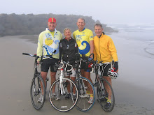
It was another day of big changes and a few surprises. We started from the Burro Jim Motel in Aguila, population 576, with a temperature of 40° F, but no wind after the strong headwinds of the prior two days. We climbed for the first 10 miles but the rest of the day was generally downhill. We went through Wickenburg, the dude ranch capital of the world and on through Phoenix to Mesa, where we ended our day in 80° F temperature.

As we have come further into Arizona the saguaro cacti have become more prevalent. We were able to ride along a canal through much of Phoenix and its suburbs. The excitement of the day was Lee breaking a ratchet on his bike shoe causing us to visit two bike shops and extend our planned 90 mi day to 106. So far, each of us has had a flat, Gaby has broken a pedal strap, Lee has broken a shoe ratchet and had to replace a chain, it is good to keep track of the location of the nearest bike store.

A word about our route and navigation. We are following the Southern Tier of the Bicycle Touring Map of the Adventure Cycling Association. They are excellent maps; they give the street name and distance of every turn as well as an elevation profile of the route (some look scary), field notes and a service directory of what is available in each place along the way. There are seven sections of maps in the set for the Southern Tier and each sheet has 15 maps of about 30 miles. So there are 107 of these strip maps in all.
Dave has a Garmin bicycle GPS. He uses a software program called MapMyRide, which uses Google Maps, to trace each route for the day. Each day’s ride is then uploaded into the Garmin. As we travel along we get a readout on the GPS of each turn. We therefore do not have to keep referring to the maps as we ride along. It is also the source of the distance, speed, elevation change and other information; a very neat device.
No comments:
Post a Comment